Kris Fowler Search Fundamentals and Timeline
10/12/2016 at 3:30 PM: Kris Fowler (34, Ohio, trail name Sherpa) was dropped off at White Pass, WA near mile 2292 of the Pacific Crest Trail. Kris was a PCT hiker returning to trail after a two day resupply in Packwood, WA. He hiked head first into a storm resulting from typhoon Songda that was being touted in a large media frenzy as the “biggest storm to hit Washington in 15 or 20 years”.
10/12/2016 at 10:00 AM: Kris’s phone’s last ping was recorded near White Pass.
10/22/2016 at 3:30 PM: Bear Hunters believe they see Kris near Blowout Mountain East of PCT mileage point (MP) 2354, 62 miles North of where he was dropped off at White Pass.
10/30/2016: Kris is announced as missing, it is reported on NBC News and the “Bring Kris Fowler/Sherpa Home” Facebook page is created.
Search and Rescue History
While Official Search and Rescue teams under the Yakima Sheriff’s Department did an initial search along the PCT from White Pass in addition to flyovers and road searches, after the initial search, they have focused primarily on the area surrounding Blowout Mountain, the location of an unconfirmed sighting by two Bear Hunter’s on 10/22/16. Blowout Mountain is East of PCT MP 2354 (62 miles North of White Pass / PCT MP 2292 where he was dropped off).
What Happened to Kris?
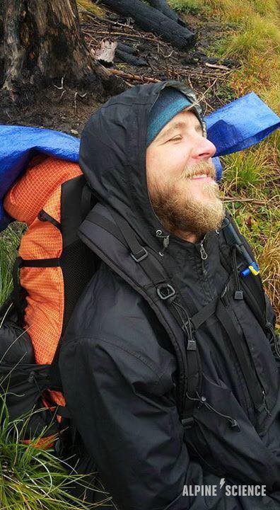
Kris woke on 10/13/18 to freezing rain, in which I believe his clothing quickly wetted out (this is common in the PNW) and he succumbed to hypothermia within a 48 hour window. For this reason, I do not believe the Bear Hunter “sighting” that took place 10 days later by Blowout Mountain is legitimate. (UPDATE: The “bear hunters” were found to have posted pictures of themselves at a football game on Facebook the same day they claimed to be “hunting” and had their Kris “sighting”.) The storm is the critical event, that is the crux that has been overlooked time and time again.
Given the severity of the storm, had Kris had made it to Highway 410 at Chinook Pass / PCT MP 2320, 28 miles from where he started at White Pass / PCT MP 2292, he would have pulled out and sought refuge in town very cold, wet and tired as all hikers were that bailed off trail during the storm. Since he did not do so, I believe he is off trail somewhere between White Pass / PCT MP 2292 and Chinook Pass / PCT MP 2320, a 28 mile section. How far off trail is the question.
For these reasons, I consider any “sightings” (including the bear hunters’ sighting) from 10/15/16 or later and any search areas North of Chinook Pass / PCT MP 2320 like Blowout Mountain to be bogus. More importantly, a singular event, the Blowout Mountain “sighting” has served to completely derail the search and has been extremely damaging to the search in its waste of resources and time. Kris did not survive the storm that ended everybody’s thru hike in one foul swoop only to have a random event cause his disappearance a few weeks later. The storm is the crux.
Designated Search Area and Map Explanation
This is the area that I believe needs to be searched. The original search topographic map was created by Doug Sanders, whom has been very helpful as a sounding board since 11/2016 when we first began dialogue regarding the search.
The search area consists of 28 mile section of the Pacific Crest Trail and it’s surrounding areas from White Pass at PCT MP 2992 to Chinook Pass at PCT MP 2020 with a primary focus on the first 20 miles North of White Pass.
This topographic map I’ve created is a simplified version of the one Doug created where I document all of my GPS tracks and the miles I’ve put in. Zoom in and play around with it.
Trace Search TracksDownloadable Topographic Map Set
In the almost two years since Kris disappeared all established trails have had traffic on them and and sometimes significant traffic in the form of hunters, hikers, and other outdoor enthusiasts. If you want to find Kris, you’re going to need to go off trail. I’ve created the following map set to use when searching. They’re 11 x 17 and your best bet is to print them at FedEx on their 32 pound paper. Do NOT compress into 8.5 x 11.
These will cost you $22 to print the set. Cut off one of the margins and fold in half to fit in a gallon zip lock. If you can’t read these then don’t use them and please don’t off trail.
HEADS UP! This is a large file with some possibly weird vector characteristics that prevented me from being able to print using FedEx’s online printing system. When I emailed the file to them and picked up my order, I only received 7 pages. When they printed a second time, a similar issue happened. On the third try all pages were printed. The moral of the story is make sure all pages are present when picking up your order.
USGS 7.5′ White Pass to Chinook Pass FSTopo 2016 7.5′ White Pass to Chinook PassTrace
#Love, backpacking, bass music, burning man, animal protein and dogs. <3


I’m not sure this web page is operational as I just attempted to use the contact button above & it appears to be a broken link. Has Kris Fowler been found / remains? / is the search ongoing? When I hear back from you I’d like to chat with you more about this.
Thanks for the heads up, I’ve fixed the issue … Unfortunately Kris has not been found. The latest information can be found on the family’s “Find Kris Fowler” facebook page and I’m sure they’re open to answering any questions you might have.
I did this section of the PCT in 2014 and it seems logical that Kris would have made it from white pass to the bumping river crossing. Since there isn’t a bridge there at the crossing, and with the amount of rain that river crossing section would be impossible so Kris probably would have gone up or down river to search for a log stretched across the river to keep going. Has anyone ever searched the river up and down for a half mile either way? It is really thick and brushy, and if he tried crossing and something happened in that area you wouldn’t find or see anything unless directly on top of the area. If he did make it across somehow and got back on, I bet he would have camped soon by fish or crag lake for the night, then tried to get off trail at laughingwater creek trail to avoid the rest of the PCT during the storm. Has anyone done a search of that trail area or road 123? Seems like 2 logical area’s to search.
Here are my tracks for when I did a route that crossed that exact section. I came up the Carlton Creek from the West up and over Carlton Pass towards Bumping Creek the East and West running parallel to Bumping River …. I had to actually wade directly in the stream itself coming over the pass as it was too steep to stand on the canyon walls, but the area is so expansive West of the Pass. The Fish Lake Bumping River section is highly trafficked, but again, lots of ground that has likely not been covered off trail and so many little places one could be hiding. There’s just so much ground to cover. https://caltopo.com/m/ENT0
Agree, there’s so much area to cover. I still think he would have had a huge issue crossing the bumping river with the flow that time of year and all the extra rain from the storm. He either fell in and drowned and the body got covered up under a sweeper log or he made camp somewhere deep in the brush off trail while attempting to find a crossing and never woke up due to hypothermia or with the storm it’s very possible that a tree came down on his tent while sleeping in the brush, and covered up his tent so I would start checking every downed tree up and down the river. The laughingwater creek trail would be the only other logical place to look IF he made it across the river, and that area doesn’t look like it’s been checked off trail. Hopefully in time he or his gear can be found and some closure can come out of this for his family. If I get a chance this summer I would love to come back out that way for a few days and help with the search.
Alex Witt came SOBO on the 13th, I believe Kris headed North on the 12th …. and Alex didn’t report any issues with crossing, so I’m not sure that the river was an issue at that point earlier in the storm.
I have been surfing gear reviews and just bumbled into this page. Here’s my reaction:
“10/12/2016 at 10:00 AM: Kris’s phone’s last ping was recorded near White Pass.”
Think carefully about that sentence. It’s possible that either the person(s) that dropped him off or someone else at White Pass is the reason that he disappeared. A lot of very bad people in the world. :-/
The couple that dropped him off voluntarily shared their experience and the last known photo of him. Very low probability of foul play when considering he hiked head first into what was the first large storm of winter with days of freezing rain while being unprepared to do so. The ping was the last ping because once you get far enough into the PCT, cell reception stops, hence that last ping.
Here’s my take on it, I grew up in WA PNW mountains and it’s my experience that every time a hiker is found after being lost, they are usually found lower in elevation than last seen. Mainly weather events are the reason or assumed reason for decent. Also, they are found off trail just farther than originally searched or underneath an area that provides some type of shelter. Knowing if Kris had his sleeping bag is important. Reason is that would make sense if he dropped gear took only his bag and emergency supplies and sought out shelter at lower elevation. If he didn’t have an accident it’s possible hypothermia set it and he simply fell asleep.
If true to the pings on his phone I’m guessing his phone got wet and shut off therefore he could very well of been farther along white pass or as I said he simply dropped pack ( as a marker ) and hiked downhill seeking shelter. If you knew what map ha had you could seek possible routes he may have gone or areas he may have looked in for shelters lakoduk was found in similar fashion re: a storm is likely that pushed her downhill and sought shelter under a fallen tree. She likely passed in her sleep from hypothermia because there was no reported trauma.
Most people can survive a storm if they have they right cold weather bag and clothes. It’s food for thought, you may need to go just a little farther off trail to more sheltered areas. People can become driven and when cold and disoriented travel farther than originally thought. I would suspect he’s not far out of the area originally thought. He just hasn’t been found because the search isn’t going out far enough- as always. They underestimate people.
Thanks for your comment!
I believe he definitely went downhill and he definitely wetted out within hours of arriving at at White Pass as there were three or so days or freezing rains that started within hours of his arrival. He had inadequate rain layers, was very thin / unhealthy / lethargic at times and that storm was what ended everyones’ thru hikes, it was exactly the storm that will cause hypothermia for those that wet out and don’t get dry / warm.
There would be little to gain from any backpacker ditching their backpack / gear as anything they carry, they use… especially after many months on the PCT, unused items are dropped quickly in the first few months and hikers have usually really refined their gear by month 4 or 5, which is where Kris was. They’re going to need all their layers, food, cooking gear, shelter, etc. so unless they were experiencing cognitive decline from the onset of hypothermia, it would be very odd for most backpackers to ditch gear.
There’s a lot of area to cover, but he’ll be found eventually. I’ve published my maps, but was unable to get the main search leader to share her previous search area tracks with me, so it was hard to see what had and had not been searched… I read something that indicates they may be sharing search data now, so hopefully that’s the case and hope he’s found soon. It’s just a question of how long it takes given the scope of the search area.
I am very active in the dirt bike riding community in the area, was just making a youtube vid about blowout mountain. I’d never heard of Kris’s disappearance, nor have I seen missing posters in the area. A missing person story situation like this needs as many people as possible looking. There are regional forums for bikers, hikers, skiers, hunters… make sure the word is out to everyone. In bad weather, that area can have visibility get to 10 feet or less. Best of luck finding Kris…and yeah, based upon what I’ve read this evening…seriously doubt he made it to Blowout Mtn in the weather described from White Pass..that’s a long route with trails that are only a couple feet wide in most places.
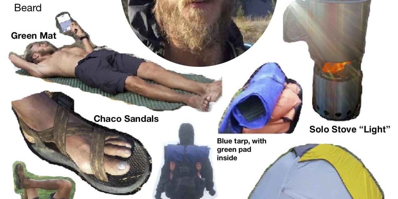
I agree with your observation Trace that Kris is somewhere off trail. He could have went off -trail to seek dryer grounds and with it being pouring rain and he was wearing sandals, that he succumbed to hyperthermia. I believe he and his belongings will be found together, off-trail between White Pass and Chinook Pass. I would not be surprised if he did not survive the evening of the 12th. If he only had sandals on, he could have easily gotten frostbite starting with his exposed feet- which would have rendered him unable to move.
We need to talk ..Hopefully your the one that listens Trace .! 509 306 5247 .
Feel free to use the contact form.